

Navigating South Korea with standard global mapping apps often leads to dead ends, missing walking routes, or outdated business names. While Naver Map and KakaoMap are the gold standards for local transit, walking directions, and real-time mapping across Korean cities, international travelers frequently struggle with how to enter Korean addresses correctly. Typing a Westernized street address straight from an English hotel booking into Naver Map or KakaoMap can return zero results or pin a location miles away from your actual destination.
The core challenge lies in understanding South Korea’s official road-name address system, the precise ordering of English address components, and knowing when to bypass street names altogether in favor of Hangul business names or subway station exit numbers. With a few basic formatting conventions and search strategies, you can locate any cafe, guest house, hotel, or attraction accurately on your first try.
- Official Address System: South Korea officially uses the road-name address system (Doromyeong Juso), consisting of a road name, building number, and detail unit (room/floor).
- English Ordering Rule: In English, the official order begins with the smallest unit and ends with the largest: [Room/Floor], [Building Number], [Road Name], [District], [City]. For example, 9, Gukhoe-daero 62-gil is correct; placing the number after the road name is incorrect.
- Copying Hangul First: Searching the original Korean text (Hangul) copied from your booking confirmation is far more reliable in Naver Map and KakaoMap than typing English phonetic translations.
- Suffixes Matter: Pay close attention to road suffixes: -daero (boulevard), -ro (road), and -gil (branch street). A numbered branch street like 323beon-gil is a distinct street, not the main boulevard.
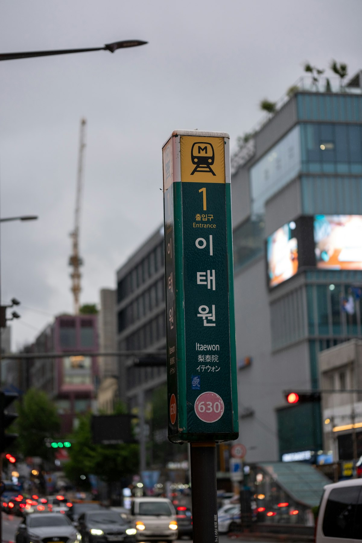
- Station Exits: Always verify subway station exit numbers (e.g., Itaewon Station Exit 1) for walking navigation, as subway exits in Seoul can be separated by several minutes of walking distance underground.
Understanding Korea’s Road-Name Address System (Doromyeong Juso)

South Korea transitioned from an older land-lot numbering system (jibeon) to the modern road-name address system (doromyeong juso). While you may still see older jibeon numbers listed on older receipts, Government24 certificates, or occasional venue websites, all modern navigation and delivery routing in Korea rely on the road-name format. The road name identifies the corridor, while the building number identifies the exact structure along that corridor based on standardized distance intervals.
In Korean, the road address moves from the macro to the micro: City (-si), District (-gu), Road Name, Building Number, and Unit/Floor. For example, Kakao’s postcode guide lists the headquarters address in Korean as 경기 성남시 분당구 판교역로 166. However, when official authorities render this address in English, the direction completely flips to match international postal conventions.
According to the Ministry of the Interior and Safety and the official road-name authority at juso.go.kr, the English road address starts with the specific unit, followed by the building number, the road name, the district, and the city. The Kakao address in English becomes 166 Pangyoyeok-ro, Bundang-gu, Seongnam-si, Gyeonggi-do, Republic of Korea. When written with an apartment or room number, Government24 illustrates the standard format as 705-1201, 42 Doum6-ro, Sejong-si, 30112, Republic of Korea (representing building 705, unit 1201). A floor can also be prefixed as 3F before the building number.
Road Suffixes and Spacing: Avoiding Critical Typos
Korean road names incorporate specific suffixes that signal the width and classification of the thoroughfare. Recognizing these suffixes prevents you from confusing major multi-lane avenues with narrow pedestrian alleyways:
- -daero (대로): A major boulevard or avenue with eight or more lanes (e.g., Gukhoe-daero, Hangang-daero).
- -ro (로): A standard road or street with two to seven lanes (e.g., Pangyoyeok-ro, Eulji-ro).
- -gil (길): A smaller branch street, side street, or alley connected to a larger road (e.g., Gukhoe-daero 62-gil).
- -beon-gil (번길): A numbered branch street branching off from a numbered intersection point (e.g., 323beon-gil).
Official guidance emphasizes that correct spacing is mandatory. The road-name authority’s standard example is 9, Gukhoe-daero 62-gil. Notice that the building number 9 appears before the road name, followed by a comma, and a space separates Gukhoe-daero and 62-gil. Searching for “Gukhoe-daero62-gil” without the space, or placing the number at the end (“Gukhoe-daero 62-gil 9”), violates official formatting rules and can trigger search errors in strict database queries.
| Address Element | Official English Format | Incorrect Tourist Mistake | Korean Equivalent |
|---|---|---|---|
| Road & Building Number | 9, Gukhoe-daero 62-gil | Gukhoe-daero 62-gil 9 | 국회대로62길 9 |
| Road Suffix Spacing | 166 Pangyoyeok-ro | Pangyoyeokro 166 | 판교역로 166 |
| Floor Designation | 3F, 42 Doum6-ro | Doum 6-ro 42 Floor 3 | 도움6로 42, 3층 |
| Apartment / Unit | 705-1201, 42 Doum6-ro | 42 Doum6-ro Apt 705 Unit 1201 | 도움6로 42, 705동 1201호 |
Step-by-Step: Entering Addresses in Naver Map and KakaoMap
Whether you are navigating down a Seoul side street with N Seoul Tower rising behind the rooftops or locating a traditional tea house in an alley, following this verified search procedure will give you the most accurate results in both mapping platforms.
Step 1: Copy the Korean Address from Your Confirmation
Whenever you book accommodation, reserve a restaurant, or purchase tickets, copy the complete Korean address written in Hangul directly from your digital voucher or email. Ensure you capture the building number and the building or venue name alongside the road name.
Step 2: Paste the Hangul Text Directly into the Search Bar
Open Naver Map or KakaoMap and paste the Hangul text directly into the search field. Both apps are built natively on Korean-language geospatial databases. Searching directly in Hangul completely bypasses transliteration mistakes, spelling variations, or discrepancies between Romanized spellings.
Step 3: If English Only, Use the Official Word Order
If your booking confirmation only provides an English address, enter it strictly using the official format: [Building Number], [Road Name] [Suffix], [District], [City]. Maintain the hyphenated road suffix (such as Pangyoyeok-ro or Gukhoe-daero 62-gil). Never place the building number at the end of the English road name.
Step 4: Search by Building Name When Street Numbers Fail
If a hotel listing omits the building number or if an English street search returns ambiguous results, search for the building or venue name itself (e.g., “Kakao Pangyo Agit” or the specific hotel title). Kakao’s postcode documentation notes that building names are stored separately from street data and frequently serve as the fastest direct search query.
Step 5: Compare the Map Pin with the Listed Neighborhood
Before confirming a transit route or hailing a taxi, look at the district (-gu) and neighborhood (-dong) shown under the pinned location. If your hotel is supposedly in Mapo-gu but the search pin drops in Gangnam-gu, you may have selected a different branch or a road with a similar prefix. Cross-reference the administrative district name before departing.
Step 6: Follow the App’s Recommended Subway Exit Number
Once your destination is set, check the transit directions for the specified subway exit. In massive underground transit hubs across Seoul and Busan, choosing the wrong exit can leave you on the opposite side of an eight-lane boulevard with no surface crosswalk. Spotting the station signage—such as an Itaewon subway station Exit 1 sign on a Seoul street—confirms you have emerged on the correct side for your final walking segment.
Step 7: Convert Uncertain English Addresses Using Official Tools
If you hold an English address that both Naver Map and KakaoMap fail to identify, do not guess alternative spellings. Visit the official government road-name portal at juso.go.kr or use the Government24 English-address conversion service to translate the address into its validated Hangul counterpart. For direct telephone inquiries regarding official address validity, the road-name authority operates a public help line at 1588-0061.
Navigating Subway Exits and Complex Intersections
One of the most valuable features inside both Naver Map and KakaoMap is exit-specific pedestrian routing. Unlike Western mapping tools that direct pedestrians simply to “the station,” Korean apps calculate foot routes directly from individual numbered station exits.
Subway stations in Korean metropolitan areas can feature anywhere from 4 to over 20 distinct exits, spanning hundreds of meters underground. Walking to an incorrect exit, surfacing, and realizing you must cross an intersection with multiple pedestrian underpasses can easily add 10 to 15 minutes of unnecessary walking. Always note the exit number specified in the app’s step-by-step route card before you tap your transit card through the turnstile.
If your phone language is set to English, the map user interface displays English labels and menus. However, changing your phone’s system language does not automatically translate every independent business pin or small cafe database entry into English. Whether every small neighborhood restaurant or market stall maintains a verified English place name in both Naver Map and KakaoMap is unconfirmed; checking the pin against the Korean address remains the safest practice.
Pro Tips for Tourists
- Save Favorites in Folders: Bookmark your hotel, favorite cafes, and subway stations in Naver Map or KakaoMap using custom lists before arriving, ensuring pins are pre-verified.
- Search by Phone Number: If a Korean business name or street address fails to populate, paste the venue’s local Korean landline telephone number (including area code) into the map search bar. In many cases, the exact business listing will appear instantly.
- Do Not Drop the Hyphen in Branch Streets: Always keep the hyphen intact for -daero, -ro, and -gil. Searching for “Euljiro 3 gil” instead of “Eulji-ro 3-gil” can confuse database filters.
- Verify Taxi Drop-Offs with Korean Text: When taking a taxi, show the driver the Korean road-name address or the destination pinned inside Kakao T or Naver Map rather than reading an English Romanized address aloud.
- Check Subway Exit Closures: Escalator and elevator construction at older stations can temporarily reroute specific exits. Check in-station informational signs if an exit gate appears barricaded.
Frequently Asked Questions
Why does Google Maps struggle with walking directions in South Korea?
South Korean national security regulations restrict high-precision government mapping data from being exported to overseas servers. Because of these legal data restrictions, Google Maps does not support native turn-by-turn walking or driving routes in Korea. Travelers must use locally hosted platforms such as Naver Map or KakaoMap for comprehensive pedestrian, bus, and subway navigation.
What is the difference between a “-ro” and a “-gil” address?
In the official road-name address system, a -ro (로) represents a primary thoroughfare containing between two and seven traffic lanes. A -gil (길) represents a smaller branch street, alley, or residential lane branching off from that main road. A numbered branch street such as 323beon-gil is a separate road corridor and should never be shortened to just the main road name.
What should I do if my booking confirmation only lists an old “-dong” lot number address?
Older land-lot addresses (jibeon) end with -dong followed by hyphenated lot numbers (e.g., Yeoksam-dong 649-4). You can paste this complete lot address directly into Naver Map or KakaoMap, as both apps maintain legacy cross-reference indices. Alternatively, enter the lot address into the official government conversion portal at juso.go.kr to obtain the matching new road-name address.